
Kanawha ZIP Directory Coverage
Kanawha County spans about 911 square miles and includes 14 municipalities, river towns, valley neighborhoods, and rural hollows. No single official county page publishes a final boundary-perfect ZIP list. The useful approach is to group the well-established community and Charleston delivery areas, then verify the exact address with USPS. The table below is a working coverage map, not a count of residents.
| ZIP Code | Areas Covered | Post Office | Notes |
|---|---|---|---|
| 25015 | Cedar Grove | Cedar Grove | Municipality and nearby delivery area |
| 25064 | Dunbar | Dunbar | Standard community delivery ZIP |
| 25071 | Elkview and Elk Valley | Elkview | Large county service area |
| 25143 | Nitro | Nitro | Grouped with Charleston processing in USPS labels |
| 25177 | St. Albans and nearby area | St. Albans | Municipality plus wider delivery area |
| 25301 | Downtown Charleston and capital core | Charleston | Also processes several special codes |
| 25302 | West Side, north Charleston, Big Chimney vicinity | Charleston | City and county-area labels can differ |
| 25303 | South Charleston | Charleston / South Charleston | Postal processing and city name can diverge |
| 25304 | Kanawha City and east Charleston | Charleston | Kanawha City is a neighborhood, not a city |
| 25311 | East End and Charleston | Charleston | Standard urban delivery area |
| 25312 | Sissonville and North Charleston | Charleston | County place may use Charleston mailing city |
| 25313 | Cross Lanes and west Charleston | Charleston | Community name differs from mailing city |
| 25314 | South Hills and county edge | Charleston | Hillside routes can cross local boundaries |
Other county community codes include Alum Creek, Bancroft, Clendenin, East Bank, Glasgow, Hernshaw, Institute, Pinch, Pratt, and Tornado. Charleston also has special, unique, and agency sequences. Those should be used only when the official address result returns that exact code. The 25305 code serves the state government and capital complex and should not be treated as a normal neighborhood roll.
Verify a Kanawha ZIP Code
Use the USPS ZIP Code Lookup for the current delivery code tied to a complete street address. This is the best control when community names conflict or a Charleston label covers an outlying place.
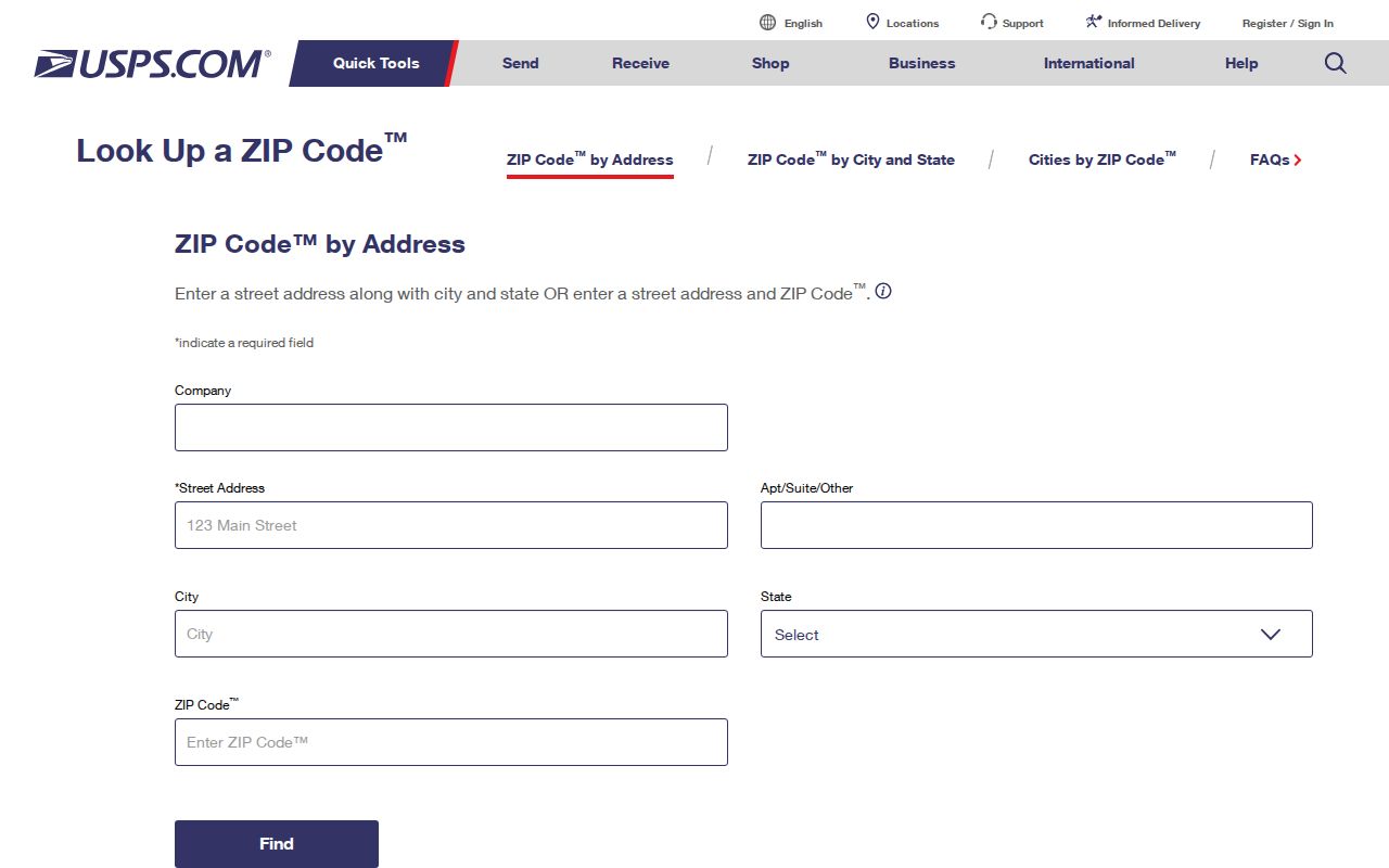
Enter the street address, city, and state as known, then compare the standardized result with the assessor's physical address. Preserve apartment or unit details. If USPS returns a postal city that differs from the local community name, keep both. The postal label guides mail, while the tax district, corporation field, and E-911 address guide county research.
Kanawha ZIP Geography
The Kanawha and Elk rivers meet at Charleston, and development follows narrow valleys between ridges. Postal routes therefore connect dense capital neighborhoods with hollows and county-edge communities in ways that do not resemble a neat grid. This helps explain why a Charleston postal name can appear with Cross Lanes, Sissonville, Big Chimney, or other local place names.
Kanawha City offers the clearest example. It has a strong 25304 postal identity, yet it is a Charleston neighborhood rather than a separate municipality. South Charleston areas may use Charleston processing labels, while 25309 can touch South Charleston and Spring Hill. For record work, retain the postal city, named community, municipality, and tax district rather than forcing them into one label.
ZIP boundary rule. A ZIP code describes mail delivery. It does not create a city boundary, tax district, voting precinct, or resident list.
Finding Kanawha Residents by ZIP
Public portals do not offer one button for every resident in a ZIP. The local assessor accepts a parcel address but has no visible ZIP field. MapWV results expose property address city, state, and ZIP, making the statewide assessment viewer the better ZIP-capable property route. The public voter lookup accepts only first name, last name, and birth date. Broader voter data requires the separate official request process.
- Confirm the full delivery address in the USPS tool and record its standardized ZIP.
- Open MapWV or the county parcel viewer and locate the address point and tax parcel.
- Read the physical address, owner name, mailing address, district, and parcel identifier separately.
- Use a name and birth date in GoVoteWV, or ask the election custodian about an allowed data request.
- Once the search reaches a named road, use the Kanawha County street records for the full address chain.
The statewide voter request form can include residence address and county, plus optional mailing address, precinct, and political districts. That is a request channel, not the same as the person-specific public lookup. Contact the Kanawha County election office for the proper scope and current terms.
Kanawha ZIP Property Fields
The assessor and MapWV distinguish parts of an address that a ZIP code directory must not merge. A property result can carry the physical or E-911 address, an owner mailing address, the tax district, and a legal parcel description. A sample Kanawha parcel even shows more than one E-911 address. That can reflect apartments, units, or alternate address points on one parcel rather than several owners.
| Field | Meaning in a ZIP search |
|---|---|
| Property address city/state/ZIP | Physical address data exposed in MapWV results |
| Owner mailing address | Where tax mail goes; may use another city or ZIP |
| District or corporation | Tax jurisdiction, not a postal boundary |
| Map, parcel, subparcel, special ID | Stable parcel keys; preserve leading zeros |
| Legal description | Lot, block, subdivision, or metes-and-bounds identity |
The WV Property Viewer is useful when a ZIP filter or statewide parcel view is needed. The county assessor remains the custodian for local assessment details. Neither tool proves who occupies a home.
Charleston Special ZIP Codes
The 25321 through 25339 sequence and other Charleston special codes can be tied to agencies, post-office functions, or unique delivery points. Later groups include codes such as 25350, 25357, 25358, 25361, 25362, 25364, 25365, 25375, 25387, 25389, 25392, and 25396. The research did not establish every one as a residential delivery area.
Do not use those codes to estimate neighborhood population or assemble a resident list. First require a USPS result for the exact address. Then compare it with the parcel's E-911 address. A state office, campus, or agency ZIP may contain many workers or mail recipients without representing a conventional block.
Note: Kanawha County's 2020 population was 180,745, but that county count cannot be divided among ZIPs without a suitable geographic dataset.
Historic Kanawha ZIP Limits
Older city directories often identify a city, suburb, road, or rural route rather than a modern ZIP. Postal ZIP codes arrived after many Kanawha directory years. A 1908 Charleston entry should not be assigned today's postal code until the old street and municipality have been mapped with a parcel, plat, or historic map.
The same household can appear under Charleston, Kanawha City, South Charleston, Dunbar, St. Albans, Nitro, or a rural place name over time. Industrial growth, river corridors, and boundary change shaped those labels. Preserve each wording and year. The Library of Congress 1902 Sanborn map can help with Charleston building context, while the county's legal description connects a parcel even when the street label shifts.
County deeds and land books use legal descriptions rather than ZIP codes. Kanawha land books from 1791 through 1962 are available through the assessor's Property Inquiry work, with later scanning described as ongoing. When a historic street cannot be placed, start with the deed book and page, subdivision or lot, then compare a plat and modern parcel. Adding a present ZIP before that match can send the search to the wrong Charleston district or nearby town.
Rural routes pose a similar issue. Frame, Dry Branch, Hernshaw, Mammoth, Miami, London, Tad, and Winifrede each have postal identities in the research table, but those names do not substitute for a parcel number. Exact county-edge addresses should be checked in both USPS and MapWV because a delivery area can cross a line that matters to the assessor.
Kanawha ZIPs Versus City Limits
A reliable ZIP code directory keeps four maps apart: postal delivery, city limits, tax districts, and voting precincts. The boundaries may overlap, but they serve different purposes. Cross Lanes may carry a Charleston postal label. Kanawha City is within Charleston. A South Charleston address can be processed through Charleston. None of those facts alone decides which local government, assessor district, or ward applies.
- ZIP and ZIP+4
- The five-digit area routes mail broadly; four more digits narrow delivery to a smaller segment.
- PO-box ZIP
- A code used for post-office boxes, not a map of home addresses.
- Unique ZIP
- A code assigned to one high-volume institution or agency.
- Carrier route
- A postal delivery path inside a ZIP, which may cross local boundary lines.
For a civic question, Charleston's ward locator converts a full address to elected representatives. For an ownership question, use the parcel. For delivery, use USPS. A Kanawha County ZIP code directory narrows the place, but the official source matched to the question supplies the answer.
The same rule applies to voter records. GoVoteWV does not browse by ZIP. It requires a known first name, last name, and birth date, then reports the person's registration status and districts. A residence address from an authorized voter-data request remains an election record, not proof of parcel ownership. Compare it with the physical parcel address and date each result.